OceanGrafix — Accurate Charts. Confident Boating.
Tide and Tidal Current Tables
Navigational information to supplement your charts
NOAA's Tide Tables and Tidal Current tables are used by mariners for navigation. They contain tide and/or tidal current predictions and associated information produced by and obtained from the Department of Commerce, National Oceanic and Atmospheric Administration, National Ocean Service.
Daily High and Low Water Predictions for more than 100 reference ports and 3,000 subordinate stations, provide U.S. coastal coverage. They are available in two volumes, covering the East and Gulf Coasts of the United States including the Bahamas and Caribbean Islands, and West Coast of the United States including the Hawaiian Islands and U.S. Territories in the Pacific.
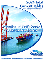
Predicted times of slack water, and times and speeds of maximum current (flood and ebb) are provided for each day of the year. More than 80 reference ports and 3,000 subordinate stations are available in two volumes, covering the Atlantic and Gulf Coasts of the United States, and the Pacific Coast of the United States including the Hawaiian Islands.